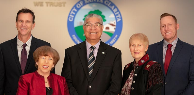
Go    


Geographic Information Systems (GIS)

Map Gallery:

Note: All maps are available for purchase or can be directly downloaded from this site. To download a PDF of the map, right click on the image of the map you want and choose the "save as" option. Please contact the GIS Division for more information about getting a printed copy.

Legal Notice: Every reasonable effort has been made to ensure the accuracy of these maps. These maps are for informational purposes only and should not be served as a legal documents. Neither the City of Santa Clarita nor any of the participants assume any liability arising from use of these maps. THE MAPS ARE PROVIDED WITHOUT WARRANTY OF ANY KIND, either expressed or implied, including, but not limited to, the implied warranties of merchantability and fitness for a particular purpose. PROPRIETARY INFORMATION: Any resale of this information is prohibited, except in accordance with a sublicensing agreement. ©City of Santa Clarita.

INFORMATION: Any resale of this information is prohibited, except in accordance with a sublicensing agreement. ©City of Santa Clarita.

Click on the map image to access the larger Adobe .pdf format file. Please be aware that some of the maps are large in size and will take a while to load.

Annexations

Scale: 1" = 3000'
Size: 36" x 24"
Last Update: February 2008
Data Source: Planning, City of Santa Clarita, 2007
Description: Map showing completed and proposed annexations with information about land use within proposed annexations.


Average Daily Traffic (ADT)

Scale: 1" = 1500'
Size: 48" x 36"
Last Update: November 2007
Data Source: Public Works: Traffic Division
Description: Average Daily Traffic (ADT) are vehicular counts in both directions taken during a typical weekly period. Actual traffic volumes may vary as ADT changes on a daily basis. Traffic counts shown by year counted from 2000 to 2005.


Enterprise Zone

Scale: Aprox. 1" = 2500'
Size: 36" x 24"
Last Update: March 2007
Data Source: Planning, Economic Development, Thomas Bros. Maps
Description: Enterprise Zone boundary with full street names and parcel outlines.


Fire Hazard Zones

Scale: 1" = 1500'
Size: 48 " x 36"
Last Update: March 2008
Data Source: Building & Safety, City of Santa Clarita and LA County Fire Department
Description: Fire Hazard map shows natural brush areas within the city of Santa Clarita. A 1000-foot buffer around the natural brush area is also shown. Information was provided by the Building & Safety Division of the City of Santa Clarita and the LACO Fire Department. Other layers included are the street centerlines and street names from Thomas Brothers (2008 Edition).


Flood Zones

Scale: 1" = 1500'
Size: 48" x 36"
Last Update: November 2007
Data Source: FEMAQ3 flood data, 1996.
Description: Flood zone map shows 100-year and 500-year zones provided by FEMA agency. Also shown are street centerlines and street names from Thomas Brothers (2004 Edition)


General Plan

Scale:
Size: 52" x 36"
Last Update: November 2007
Data Source: General Plan, City of Santa Clarita Planning
Description: Map showing General Plan designations for the City


Landscape Maintenance Districts

Scale:
Size: 11" x 17"
Last Update: November 2007
Data Source: Landscape Maintenance Division, City of Santa Clarita
Description: Map showing location of all landscape maintenance districts within the City.


Seismic Hazard Zones

Scale: 1" = 1500'
Size: 48" x 36"
Last Update: November 2007
Data Source: California Geological Survey, 1999, 2002
Description: Seismic Hazard map shows earthquake-induced landslide and liquefaction hazard zones within the City of Santa Clarita. Information obtained from the California Geological Survey (March 1999, amended September 2002). Also included is the street centerlines and street names from Thomas Brothers (2004 Edition).


Significant Ridgelines

Scale: 1" = 1500'
Size: 52" x 36"
Last Update: December 2006
Data Source: Ridgelines, City of Santa Clarita Planning, 1991. USGS 30m DEMs
Description: Map showing Significant ridgelines as identified by the 1991 General Plan


Streets Map of Santa Clarita

Scale: 1" = 1500'
Size: 48" x 36"
Last Update: March 2008
Data Source: Thomas Brothers Street Network, 2008
Description: Street centerline map of the City with ownership boundaries, parks, and cultural points of interest. Source of the data is Thomas Brothers (2008 Edition).


Subdivision Activity

Scale: 1" = 3000'
Size: 84" x 36"
Last Update: City: February, 2005 County: June 30, 2004
Data Source: Planning, City of Santa Clarita, 2005 and Regional Planning, LA County, 2004
Description: Development activity in the Santa Clarita Valley area.


ZIP Code Map

Scale: 1" = 1800'
Size: 48" x 36"
Last Update: November 2007
Data Source: United States Postal Service
Description: Updated ZIP code Boundaries for 2002. Updated January 5th 2002. Information provided by the United States Postal Services.


Zoning Map

Scale: 1" = 1500'
Size: 48" x 36 "
Last Update: November 2007
Data Source: Planning, City of Santa Clarita, 2006
Description: Zoning map shows the city zoning classification with parcel boundaries from LA County Assessors Office. Street names are also included for easy reference.


Back to GIS Home Page